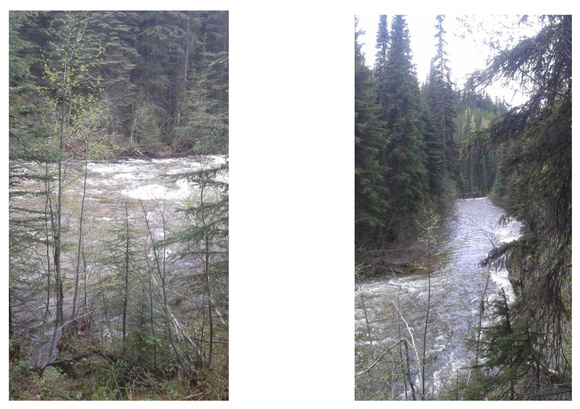
West Kettle River
This river can be heard as a background tune when on the observatory grounds, and sometimes rocks can be heard rolling down the river. It can be viewed quite easily from a Big White road bridge just a few kilometers east past the observatory. If you want to view the part that flows close to the observatory prepare yourself for a black diamond vertical hike. It only takes 10 minutes of terror to hike down, and 10 minutes of high heart rate to hike up. From the observatory entry road cross Big White road and walk 180 paces east on Big White road, look for the “stop sign ahead” sign on the north branch of the 201 as a marker to indicate you have gone far enough east. Here you should be able to see orange flagging tape on the south side of Big White road at the place to start your adventure. The trail is well flagged all the way down. At one point you will see 2 flags going in roughly the same direction but alternate routes, either one will do, so long as you go downhill carefully you will reach the goal and dip a foot in the WKR if so inclined. Several very fresh bear scat signs were observed by the Lewis and Clark expedition.